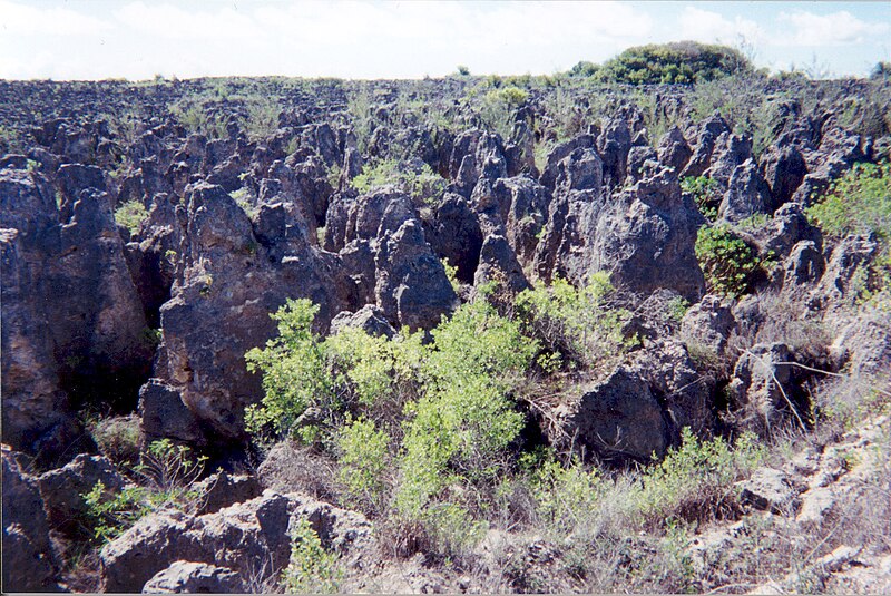
ファイル:Karst following phosphate mining on Nauru.jpg
表示

このプレビューのサイズ: 800 × 535 ピクセル。 その他の解像度: 320 × 214 ピクセル | 640 × 428 ピクセル | 1,024 × 684 ピクセル | 1,280 × 855 ピクセル | 1,787 × 1,194 ピクセル。
元のファイル (1,787 × 1,194 ピクセル、ファイルサイズ: 835キロバイト、MIME タイプ: image/jpeg)
ファイルの履歴
過去の版のファイルを表示するには、その版の日時をクリックしてください。
| 日付と時刻 | サムネイル | 寸法 | 利用者 | コメント | |
|---|---|---|---|---|---|
| 現在の版 | 2007年4月3日 (火) 02:10 |  | 1,787 × 1,194 (835キロバイト) | Indolences | |
| 2006年5月5日 (金) 05:21 |  | 480 × 321 (75キロバイト) | PDH | Nauruan districts of Denigomodu and Nibok. ''Courtesy: U.S. Department of Energy's Atmospheric Radiation Measurement Program.'' Source: [http://images.arm.gov/armimages.nsf/a89ad461c472386388256cf3007aeb57/500d8248a90eea9488256cc400727e96?OpenDocument&H |
ファイルの使用状況
以下のページがこのファイルを使用しています:
グローバルなファイル使用状況
以下に挙げる他のウィキがこの画像を使っています:
- az.wikipedia.org での使用状況
- bg.wikipedia.org での使用状況
- bh.wikipedia.org での使用状況
- ca.wikipedia.org での使用状況
- de.wikipedia.org での使用状況
- el.wikipedia.org での使用状況
- en.wikipedia.org での使用状況
- en.wikiquote.org での使用状況
- eo.wikipedia.org での使用状況
- es.wikipedia.org での使用状況
- eu.wikipedia.org での使用状況
- fa.wikipedia.org での使用状況
- fr.wikipedia.org での使用状況
- ha.wikipedia.org での使用状況
- he.wikipedia.org での使用状況
- id.wikipedia.org での使用状況
- ig.wikipedia.org での使用状況
- mk.wikipedia.org での使用状況
- na.wikipedia.org での使用状況
- new.wikipedia.org での使用状況
- pl.wikipedia.org での使用状況
- pt.wikipedia.org での使用状況
- ro.wikipedia.org での使用状況
- ru.wikipedia.org での使用状況
- si.wikipedia.org での使用状況
- sv.wikipedia.org での使用状況
- tr.wikipedia.org での使用状況
- uk.wikipedia.org での使用状況
- vi.wikipedia.org での使用状況
- www.wikidata.org での使用状況
このファイルのグローバル使用状況を表示する。
