
ファイル:Wales Gwynedd locator map.svg

この SVG ファイルのこの PNG プレビューのサイズ: 502 × 600 ピクセル. その他の解像度: 201 × 240 ピクセル | 402 × 480 ピクセル | 643 × 768 ピクセル | 857 × 1,024 ピクセル | 1,714 × 2,048 ピクセル | 1,047 × 1,251 ピクセル。
元のファイル (SVG ファイル、1,047 × 1,251 ピクセル、ファイルサイズ: 151キロバイト)
ウィキメディア・コモンズのファイルページにある説明を、以下に表示します。
|
概要
| 解説 |
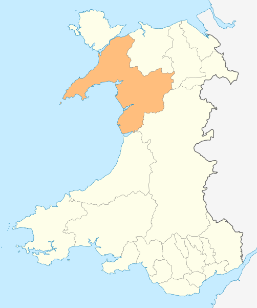
Deutsch: Lagekarte von Gwynedd in Wales
English: Locator map of Gwynedd in Wales |
| 日付 | |
| 原典 | 投稿者自身による著作物, File:Wales location map.svg |
| 作者 | NordNordWest |
| 許可 (ファイルの再利用) |
この作品の著作権者である私は、この作品を以下のライセンスで提供します。 このファイルはクリエイティブ・コモンズ 表示-継承 3.0 非移植ライセンスのもとに利用を許諾されています。
|

|
この地図は、ドイツ語版の(地図研究室)で制作、もしくは改善されたものです。更なる改善の為、地図を提案することもできます。
|
ファイルの履歴
過去の版のファイルを表示するには、その版の日時をクリックしてください。
| 日付と時刻 | サムネイル | 寸法 | 利用者 | コメント | |
|---|---|---|---|---|---|
| 現在の版 | 2010年5月4日 (火) 18:52 | | 1,047 × 1,251 (151キロバイト) | NordNordWest | {{int:filedesc}} {{Information |Description= {{de|Lagekarte von Gwynedd in Wales}} {{en|Locator map of Gwynedd in Wales}} |Source={{Own}} |Date=2010-05-04 |Author={{U|NordNordWest}} |Permission={{self|cc-by-sa-3.0}} |other_versions= }} {{Kartenwerkstatt} |
ファイルの使用状況
以下の 2 ページがこのファイルを使用しています:
グローバルなファイル使用状況
以下に挙げる他のウィキがこの画像を使っています:
- en.wikipedia.org での使用状況
- Caernarfon
- Gwynedd
- Portmeirion
- Beddgelert
- Golf Halt railway station
- Harlech Castle
- Criccieth Castle
- Blaenau Ffestiniog
- Aberdaron
- Berwyn range
- Porthmadog
- Bangor, Gwynedd
- Bethesda, Gwynedd
- Ffestiniog
- Llan Ffestiniog
- Harlech
- Criccieth
- Pwllheli
- Bardsey Island
- Llanberis
- Barmouth
- Dolgellau
- Tywyn
- Fairbourne
- Tremadog Bay
- Caernarfon Bay
- Abersoch
- Llanbedr
- Aberdyfi
- Nasareth
- Saint Tudwal's Islands
- Cnicht
- Y Llethr
- Garnedd Ugain
- Yr Aran
- Llyn Llydaw
- Nefyn
- Afon Mawddach
- Trawsfynydd
- Bala, Gwynedd
- Tremadog
- Tanygrisiau
- Llanystumdwy
- Y Rhiw
- Afon Ogwen
- Llanfaglan
- Fort Belan
- List of places in Gwynedd
- Y Felinheli
- River Dwyryd
このファイルのグローバル使用状況を表示する。