ファイル:SAR-Mainstem-Map med.jpg
表示
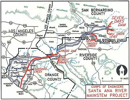
SAR-Mainstem-Map_med.jpg (450 × 347 ピクセル、ファイルサイズ: 48キロバイト、MIME タイプ: image/jpeg)
ファイルの履歴
過去の版のファイルを表示するには、その版の日時をクリックしてください。
| 日付と時刻 | サムネイル | 寸法 | 利用者 | コメント | |
|---|---|---|---|---|---|
| 現在の版 | 2009年12月18日 (金) 01:21 |  | 450 × 347 (48キロバイト) | Shannon1 | {{Information |Description={{en|1=Map of the 100-year floodplain of the Santa Ana river with flood control structures labelled}} |Source=http://www.ocflood.com/SARP.aspx |Author=U.S. Army Corps of Engineers |Date= |Permission= |other_versions= }} [[Categ |
ファイルの使用状況
以下のページがこのファイルを使用しています:
グローバルなファイル使用状況
以下に挙げる他のウィキがこの画像を使っています:
- en.wikipedia.org での使用状況
- nl.wikipedia.org での使用状況


