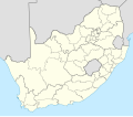
ファイル:Map of South Africa with district borders (2009).svg
表示

この SVG ファイルのこの PNG プレビューのサイズ: 684 × 599 ピクセル. その他の解像度: 274 × 240 ピクセル | 548 × 480 ピクセル | 876 × 768 ピクセル | 1,168 × 1,024 ピクセル | 2,337 × 2,048 ピクセル | 809 × 709 ピクセル。
元のファイル (SVG ファイル、809 × 709 ピクセル、ファイルサイズ: 1.32メガバイト)
ファイルの履歴
過去の版のファイルを表示するには、その版の日時をクリックしてください。
| 日付と時刻 | サムネイル | 寸法 | 利用者 | コメント | |
|---|---|---|---|---|---|
| 現在の版 | 2011年3月30日 (水) 13:00 |  | 809 × 709 (1.32メガバイト) | Htonl | bugfix |
| 2011年3月30日 (水) 01:22 |  | 809 × 709 (1.32メガバイト) | Htonl | == Summary == {{Information |Description ={{en|1=Map of South Africa with the borders of the provinces and the district and metropolitan municipalities, as they were after the transfer of Merafong City to Gauteng on 22 April 2009}} |Source ={{o |
ファイルの使用状況
以下のページがこのファイルを使用しています:

