
ファイル:FortTiconderogaLayout1758.png
このプレビューのサイズ: 800 × 518 ピクセル。 その他の解像度: 320 × 207 ピクセル | 640 × 414 ピクセル | 1,024 × 663 ピクセル | 1,327 × 859 ピクセル。
元のファイル (1,327 × 859 ピクセル、ファイルサイズ: 2.42メガバイト、MIME タイプ: image/png)
ウィキメディア・コモンズのファイルページにある説明を、以下に表示します。
|
| 解説 |
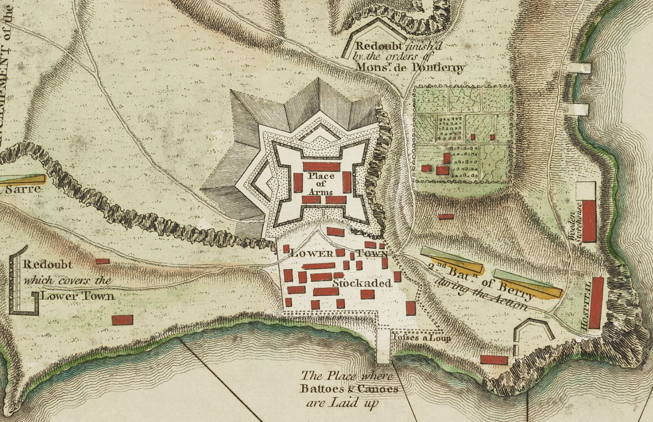
English: This is a detail from the source map showing the the layout of Fort Ticonderoga (then known as Fort Carillon) in 1758. |
||||||||||||||||||||||
| 日付 |
|
||||||||||||||||||||||
| 原典 |
The source image is from the Library and Archive of Quebec. |
||||||||||||||||||||||
| 作者 |
|
||||||||||||||||||||||
| 許可 (ファイルの再利用) |
|
||||||||||||||||||||||
| その他のバージョン |
このファイルの派生的著作物: Fort Ticonderoga 1758 Restored.png File:TiconderogaJeffreys1758.jpg (original uncropped map) |
||||||||||||||||||||||
この画像には画像編集が施されています。原本に対して次のデジタル的な変更が行われました。
|
ファイルの履歴
過去の版のファイルを表示するには、その版の日時をクリックしてください。
| 日付と時刻 | サムネイル | 寸法 | 利用者 | コメント | |
|---|---|---|---|---|---|
| 現在の版 | 2009年2月10日 (火) 16:17 | | 1,327 × 859 (2.42メガバイト) | Magicpiano | {{Information |Description={{en|1=This is a period map showing the forces arrayed at the Battle of Carillon at Fort Ticonderoga (then known as Fort Carillon) in 1758. It is captioned ''A Plan of the Town |
ファイルの使用状況
以下のページがこのファイルを使用しています:
グローバルなファイル使用状況
以下に挙げる他のウィキがこの画像を使っています:
- en.wikipedia.org での使用状況
- fr.wikipedia.org での使用状況
- sv.wikipedia.org での使用状況