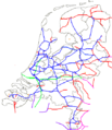
ファイル:Elektrificatiekaart.png
表示
Elektrificatiekaart.png (450 × 522 ピクセル、ファイルサイズ: 18キロバイト、MIME タイプ: image/png)
ファイルの履歴
過去の版のファイルを表示するには、その版の日時をクリックしてください。
| 日付と時刻 | サムネイル | 寸法 | 利用者 | コメント | |
|---|---|---|---|---|---|
| 現在の版 | 2017年4月29日 (土) 09:27 |  | 450 × 522 (18キロバイト) | Wim1234567890 | Corrected: Zevenaar-Emmerich, Hoekselijn and Zwolle-Wierden. |
| 2012年7月18日 (水) 20:51 |  | 450 × 522 (19キロバイト) | Wim1234567890 | Inclusief spoorlijnen tot 20km over grens | |
| 2012年6月24日 (日) 15:48 |  | 450 × 522 (18キロバイト) | Wim1234567890 | 25 KV en 3000VDC en 15KV 16 2/3 HZ | |
| 2012年6月24日 (日) 13:41 |  | 450 × 522 (18キロバイト) | Wim1234567890 | Aangevuld met Sloelijn | |
| 2012年6月24日 (日) 12:49 |  | 450 × 522 (36キロバイト) | Wim1234567890 | Aangevuld met 25KV lijnen en buitenlandse spanningen. | |
| 2012年6月24日 (日) 12:27 |  | 450 × 522 (36キロバイト) | Wim1234567890 | Aangevuld met 25 KV lijnen en buitenlandse spanningen | |
| 2012年6月24日 (日) 10:53 |  | 450 × 522 (36キロバイト) | Wim1234567890 | Aangevuld met 25KV lijnen | |
| 2007年3月16日 (金) 08:13 |  | 450 × 522 (35キロバイト) | SieBot | {{Information |Description=elektrificatiekaart van Nederland, eigen werk Spoorlijn |Source=Originally from [http://nl.wikipedia.org nl.wikipedia]; description page is/was [http://nl.wikipedia.org/w/index.php?titl |
ファイルの使用状況
以下のページがこのファイルを使用しています:
グローバルなファイル使用状況
以下に挙げる他のウィキがこの画像を使っています:
- de.wikipedia.org での使用状況
- en.wikipedia.org での使用状況
- hu.wikipedia.org での使用状況
- nl.wikipedia.org での使用状況


