
ファイル:Caerphilly UK location map.svg

この SVG ファイルのこの PNG プレビューのサイズ: 423 × 599 ピクセル. その他の解像度: 169 × 240 ピクセル | 339 × 480 ピクセル | 542 × 768 ピクセル | 723 × 1,024 ピクセル | 1,446 × 2,048 ピクセル | 894 × 1,266 ピクセル。
元のファイル (SVG ファイル、894 × 1,266 ピクセル、ファイルサイズ: 625キロバイト)
ウィキメディア・コモンズのファイルページにある説明を、以下に表示します。
|
| 解説 |
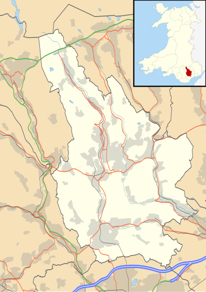
Blank map of Caerphilly, UK with the following information shown:
Equirectangular map projection on WGS 84 datum, with N/S stretched 160% Geographic limits:
|
| 日付 | |
| 原典 |
|
| 作者 | Nilfanion, created using Ordnance Survey data |
| 許可 (ファイルの再利用) |
このファイルはクリエイティブ・コモンズ 表示-継承 3.0 非移植ライセンスのもとに利用を許諾されています。 帰属: Contains Ordnance Survey data © Crown copyright and database right
|
| その他のバージョン | File:Caerphilly UK map.svg - Blank map |
ファイルの履歴
過去の版のファイルを表示するには、その版の日時をクリックしてください。
| 日付と時刻 | サムネイル | 寸法 | 利用者 | コメント | |
|---|---|---|---|---|---|
| 現在の版 | 2010年9月26日 (日) 19:28 | | 894 × 1,266 (625キロバイト) | Nilfanion | {{Information |Description=Blank map of Caerphilly, UK with the following information shown: *Administrative borders *Coastline, lakes and rivers *Roads and railways *Urban areas Equirectangular map projection on WGS 84 datum, with N/S st |
ファイルの使用状況
以下の 5 ページがこのファイルを使用しています:
グローバルなファイル使用状況
以下に挙げる他のウィキがこの画像を使っています:
- ar.wikipedia.org での使用状況
- ceb.wikipedia.org での使用状況
- cy.wikipedia.org での使用状況
- en.wikipedia.org での使用状況
- Abercarn
- Caerphilly
- Welsh Football League Division Two
- Bargoed
- Caerphilly County Borough
- Rhymney
- Risca
- Caerphilly District Miners Hospital
- Crumlin, Caerphilly
- Cwmcarn
- Ystrad Mynach
- Trethomas
- Bedwas
- Machen
- Newbridge, Caerphilly
- Blackwood, Caerphilly
- Aberbargoed
- Abertysswg
- Hengoed
- Pengam
- Van, Caerphilly
- Cefn Mably House
- New Tredegar
- Pontllanfraith
- Nelson, Caerphilly
- Maesycwmmer
- Fochriw
- Aberbargoed Hospital
- Oakdale Hospital
- Redwood Memorial Hospital
- Ystrad Mynach Hospital
- Oakdale, Caerphilly
- Penmaen, Caerphilly
- Llanbradach
- Hafodyrynys
- Senghenydd
- Argoed, Caerphilly
- Markham, Caerphilly
- Penallta Colliery
- Ynysddu
- Darran Valley
- Module:Location map/data/Wales Caerphilly/doc
- Deri, Caerphilly
- Tir-Phil
- Cefn Fforest
- Morgraig Castle
- List of Sites of Special Scientific Interest in Caerphilly County Borough
このファイルのグローバル使用状況を表示する。